Why Value Per Acre Matters
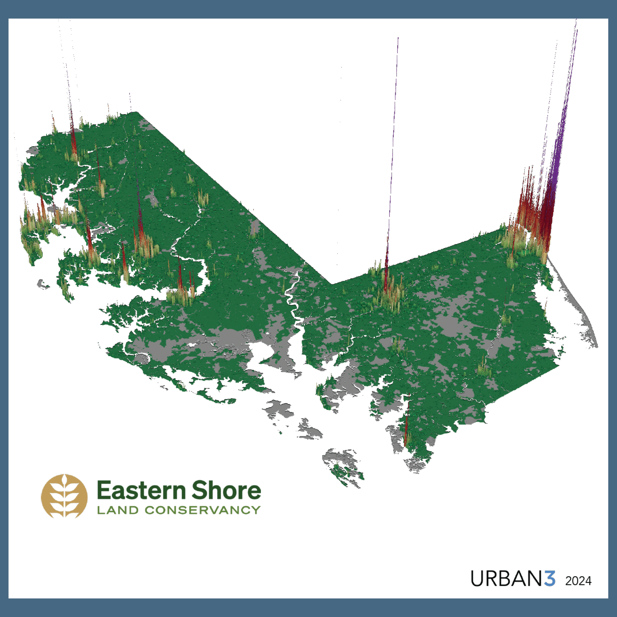
Not all land uses contribute equally to a community’s ability to maintain roads, utilities, stormwater systems, public spaces, and other essential infrastructure. Some patterns of development generate enough value to support these ongoing costs, while others require continued public subsidy over time.
Value Per Acre helps shift the conversation from how much development is occurring to how efficiently land is being used. Land is a finite resource, and this measurement is critical in understanding that limitation. This perspective also supports more informed decisions about zoning, redevelopment, and reinvestment, especially in existing towns, neighborhoods, and commercial areas.
Infrastructure as Land Stewardship
Maintaining and reinvesting in existing infrastructure is a form of good land stewardship. Focusing growth on places that already have services reduces the need to extend costly infrastructure into farmland, forests, and environmentally sensitive areas.
By aligning land use decisions with infrastructure capacity, communities can strengthen their fiscal resilience while protecting the Eastern Shore’s working lands and natural resources. Value Per Acre analysis helps illustrate how compact, well‑maintained places support both community vitality and conservation goals.
Using This Research Locally
Value Per Acre data is used to support conversations about zoning, land use, and future growth across the Eastern Shore. It provides a shared, data‑driven framework for understanding how land use choices today influence long‑term community health, infrastructure maintenance, and conservation outcomes.
If you would like to learn more about Value Per Acre data, request a presentation, or access the data as a GIS project file with a data dictionary, please contact Owen Bailey, Director of Land Use and Policy, at Eastern Shore Land Conservancy.